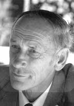
 Friday 19 December 2014 sees us gather to farewell John Hickman QSO, Director of the New Zealand Meteorological Service from 1977 to his retirement in 1988. John passed away on 13 December aged 87, after a life of significant contribution to New Zealand's weather knowledge and progress.
Christmas past
Christmas Day in New Zealand can be a hit and miss affair, weather wise. Some years, a High arrives in time for Santa. Christmas Day 2009 was beautifully fine and warm across the country, with Dunedin hitting 32°C, and many other centres approaching 25°C.
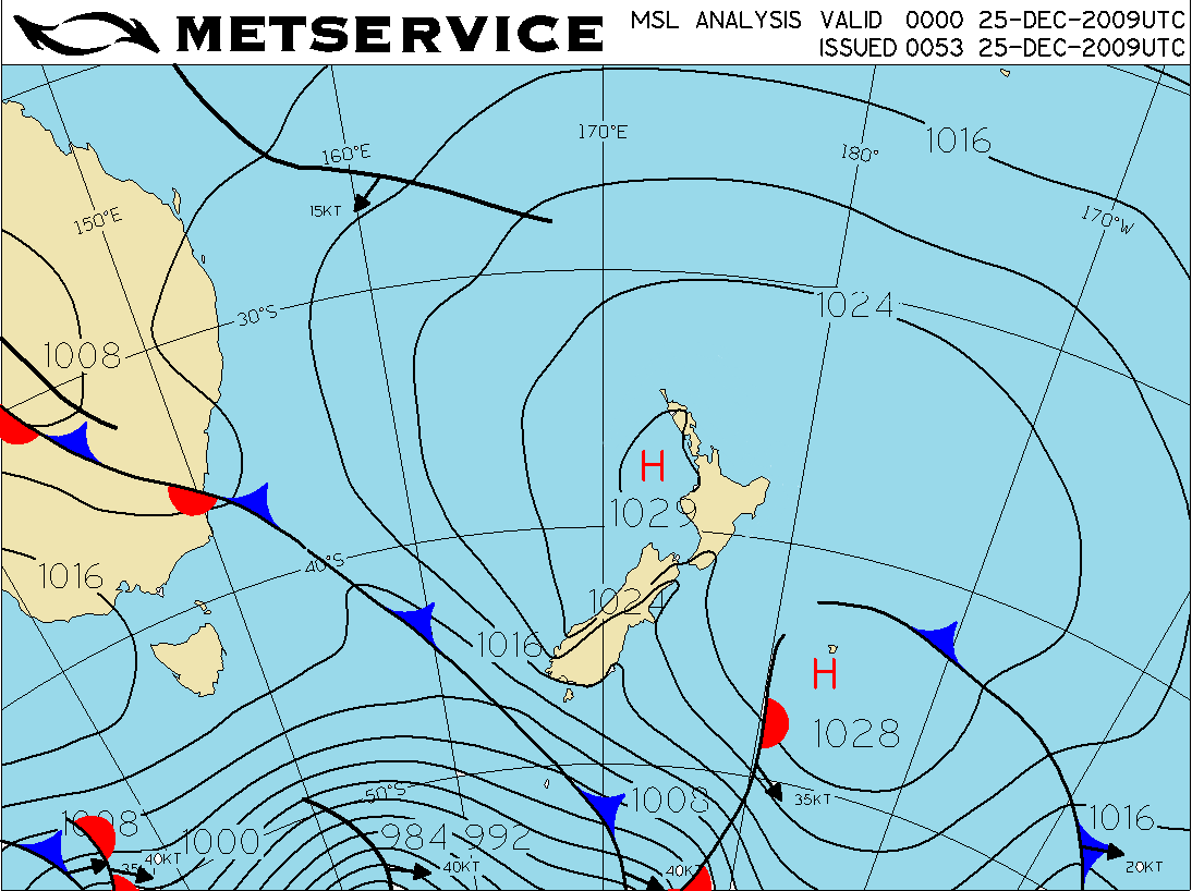 Midday analysis for 25th December 2009.
Radar and mariners – a long relationship
The development of modern radar started in 1886, when German physicist Heinrich Hertz showed that radio waves could be reflected from solid objects. In 1904, another German, Huelsmeyer, was the first to build a simple ship detection device, successfully detecting a ship in dense fog. In the pre-war period (the 1930s), many nations were working on radar devices. A major advance occurred once systems were developed that allowed short ‘pulses’ of radio energy to be generated, allowing the range of the object to be determined by timing the pulses.
Antarctic Adventure
During October 2014, MetService Meteorologist John Law spent five days in Antarctica. We thought you would be interested to see Antarctica through John's eyes, so he kept a blog to report back on what he was up to each day!
New Masters in Meteorology a first for New Zealand
May 2009
Victoria University of Wellington will offer the country’s first Master’s degree in meteorology, in partnership with New Zealand’s official weather forecaster MetService.
A better view out to sea in the far North
MetService’s long-range weather radar, situated near Kaeo in Northland, officially commenced operations on Monday 28 July 2014, with early imagery from the radar enabling MetService forecasters to provide very valuable information to Civil Defence and the public ahead of the June storms experienced in the region that year.
The Northland floods of July 2014
The Northland flooding event, July 8th to 12th 2014
The average July monthly rainfall total at Kaikohe, Northland, is around 180mm. In just one week in July 2014 the rainfall recorded there totalled 477mm, and that wasn’t even the wettest part of the region.
The hectoPascal and Air Pressure
Written by Chris Webster Metservice Meteorologist
Recalling the Clutha Flood of 1878
Written by Erick Brenstrum, Meteorologist
Activity for World Meteorological Day 2014: Make Your Own Observations
Written by John Law, Meteorologist