Compared to 2023, looking back on this past year may have felt like a relatively quiet year of weather for Aotearoa New Zealand. But digging into the details reveals many weather events that marked 2024. There were two Red Warnings issued, and a heavy rain event along the western South Island in April came remarkably close to being the third. Records were broken across the spectrum, spanning wet and dry, warm and cold.
January
The year began warm and humid, with a mostly settled weather regime keeping days hot and nights muggy. Between 19 and 23 January, Auckland experienced daytime temperatures of 27 to 30°C and overnight lows of 20 to 21°C. This unusual run of heat occurs roughly once per decade in the historical record and made for some uncomfortable nights. Elsewhere, Wellington Airport marked Anniversary Day (22 January) with its highest January temperature on record, 29.6°C. Meanwhile, MetService continued its summer trial of Heat Alerts.
Northwesterly winds that delivered the warm air also brought moisture to the western South Island. On the 18th, MetService issued the first Red Warning of the year for heavy rain in the West Coast Region, with 400 to 650 mm recorded over 48 hours in Westland ranges. Rivers rose to alert levels, with impacts felt even on Canterbury’s side of the divide.
In contrast, January was another dry month for eastern South Island areas after a parched December. Ashburton reported 40 mm of rainfall (January average 63.5 mm), while Blenheim tallied just 15 mm (January average 48 mm).
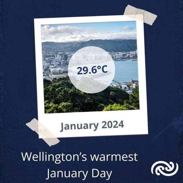
Wellington Airport reached 29.6°C on 22 January 2024, the warmest January temperature recorded there (records go back to 1972)
February
February’s active westerly pattern—characteristic of a waning El Niño summer—brought rain to the western South Island but left other regions dry. Many North Island locations recorded over 15 consecutive dry days (less than 1 mm of rain): Auckland Airport had a 21-day streak, and Gisborne went 23 days without significant rainfall. Similarly, Blenheim received its only notable rain at the start of the month.
Several northwesterly events also served to dry out soils and vegetation, and combined with the gusty winds, it was no wonder vegetation fires plagued the eastern South Island during this month. The most notable of these were the fires in the Lee Valley in Tasman and the Port Hill fires in Canterbury in the middle of the month.

Auckland Airport had a 21-day streak of dry weather (less than 1 mm of rain)
March
An unseasonable cold snap in early March brought early season snow and issued the year’s first Road Snowfall Warning for the Crown Range Road on the 5th—two weeks earlier than last year. Daytime temperatures in Southland and Dunedin resembled June averages, with frosts following on the 6th. The rest of March remained chilly, with major population centres including Auckland, Hamilton, Wellington, Christchurch, Timaru, and Dunedin recording temperatures around 1°C below normal. Auckland experienced its coldest March in 15 years, with an average 1.1°C below normal.
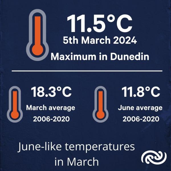
Temperatures in Dunedin at times were more reminiscent of June than March
April
The standout weather system of the month would turn out to be one of the more severe weather events of the year. Between the 9th and 12th, a slow-moving front laden with moisture stalled over Aotearoa, blocked by a high-pressure system to the east. The result was widespread heavy rain, gusty winds, and severe thunderstorms. The West Coast saw 500 to 800 mm in the ranges, triggering swollen rivers and slips that cut off roads. This event was what MetService meteorologists refer to in-house as a “Dark Orange” Warning, i.e. more than a normal Orange Warning and teetering on Red Warning status.
The rain had far-reaching impacts beyond the West Coast. Otago and Canterbury headwaters experienced significant rainfall, causing damage to bridges and infrastructure. Wānaka, Dunedin, Queenstown, and Blenheim all logged one of their top five wettest April days. Throughout the week, the weather map of Aotearoa was a patchwork of severe weather Warnings and Watches.
Following this turbulent spell, however, the remainder of April saw more settled weather apart from sporadic fast-moving fronts.
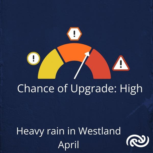
A severe weather event in the week of 8 to12 April came very close to having a Red Warning issued for Westland
May
If March started autumn on a cooler note, May echoed the cold weather sentiment to cap the season. Nationwide average temperatures were 1 to 2°C below normal, making it the coldest May since 2009. Southerly and southwesterly circulations brought severe frosts, with Christchurch dipping to -6.3°C on the 10th, giving May records a run for their money.
Overall, most of the country saw little wet weather. On the one hand, the eastern South Island continued its drier than average run, while on the other, aurora hunters around the country were able to take advantage of the clearer skies in the second weekend of the month to capture the rare phenomenon. However, a Tasman Sea low mid-month brought rain to the North Island and snow to the South. Auckland saw surface flooding, but rainfall helped replenish totals after a relatively dry start to the year.

Auroras were visible in many parts of Aotearoa New Zealand on 11 May 2024
June
Winter began mildly, with unseasonably warm conditions across the upper and eastern North Island, Otago, and southern Canterbury Plains. Many locations, including Kerikeri, Tauranga, and Timaru, recorded top-five warmest June days. Northerly winds driven by a low-pressure system to the west brought humid air and occasional fronts.
Later in June, rainfall increased in the eastern North Island. Gisborne Airport recorded its second-wettest day on the 25th with 125.7 mm, contributing to its third-wettest June on record (261.4 mm).
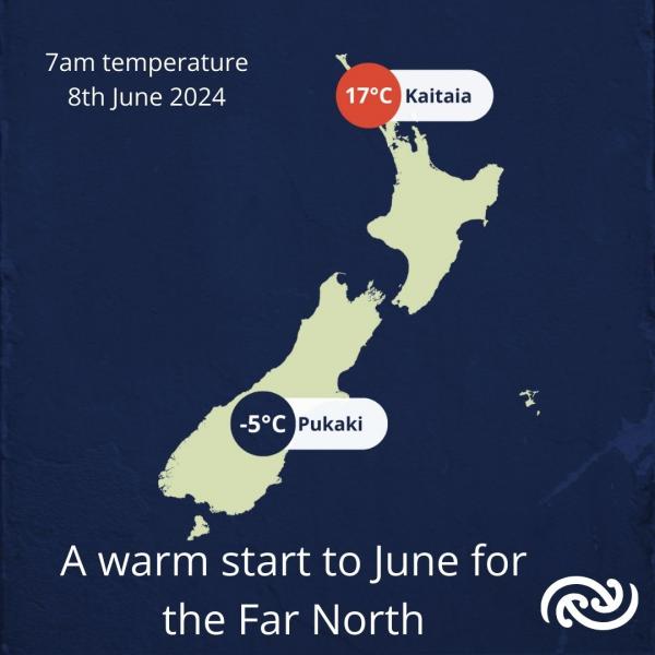
A sharp contrast in temperatures at 7am on 8 June where Kaitaia was 17°C while Pukaki was -5°C
July
One of the memorable weather features of July was a strong high pressure that settled over the country at the start of the second week. This strong high-pressure system saw barometric pressures exceeding 1040 hPa, a rare occurrence last seen in 2022.
This period of settled weather brought warmer than average temperatures to most of the country, but the rest of the month was starkly different. Orange Warnings for Heavy Snow covered the last few days of the month in Canterbury and Otago, with Watches for Southland.
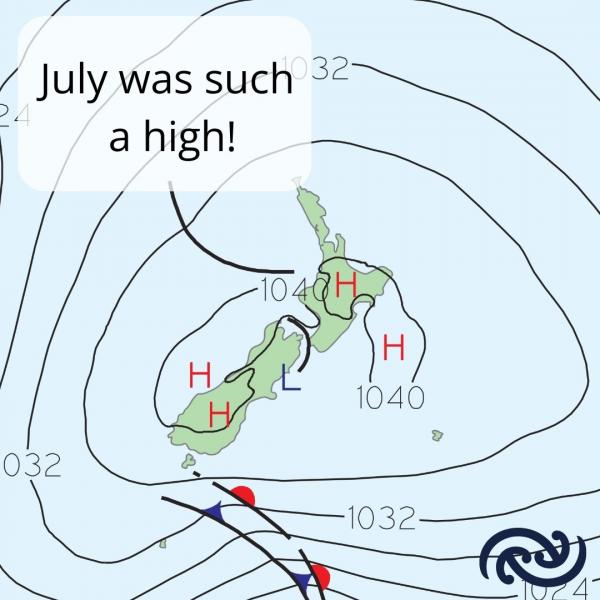
High pressure of over 1040 hPa was recorded over Aotearoa New Zealand during July
August
August featured a mix of winter chill and dramatic weather. Frosty mornings began the month, with Christchurch recording -6.1°C on the 4th. Snowfall in elevated South Island areas closed roads like Lindis Pass in the second week and saw snow reach sea-level in the third week.
On the 12th, a memorable southerly blast swept up the east of the country, starting in Canterbury, reaching the capital around school pickup, and up the eastern North Island the rest of the day. This brought dramatic thunderstorms that turned day to night within minutes, hail, and a sudden plunge in temperature.
Late August saw frequent westerlies delivering heavy rain and strong winds. Pahiatua experienced significant flooding on the 18th, and Wellington saw slips and flooding on the 26th. Amid the storms, warm temperatures arrived in the east, with Napier Airport hitting 22.6°C on the 29th, its hottest August day on record. Volcanic eruptions at Whakaari/White Island added complexity, with ash disrupting flights in Whakatāne and Rotorua on the 22nd.
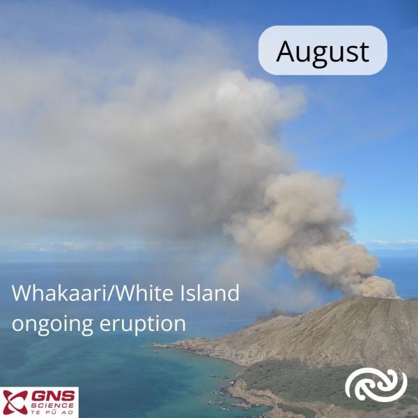
Whakaari/White Island saw ongoing eruptions from late July throughout August (image courtesy of GNS)
September
Spring westerlies prevailed in September, with several fast-moving fronts from the Tasman Sea. Four strong wind events marked the month’s first ten days, and a dry pattern persisted for central and northern regions. Whakatāne, Tauranga, Rotorua, and Kerikeri all recorded their driest Septembers.
In contrast, Milford Sound surpassed 1,000 mm of rain, which only occurs around 5% of the time, and with 202.2 mm of rain, Queenstown saw their wettest month since 1994.
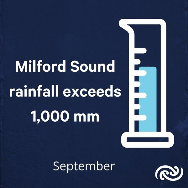
Milford Sound recorded over 1,000 mm of rain during September 2024
October
October began with the year’s second Red Warning, the first ever for eastern Otago and Dunedin. Following a wet September, persistent heavy rain overwhelmed the region. Oamaru and Dunedin received over two months’ worth of rain in a couple of days. This prompted a state of emergency and widespread impacts such as road closures, damage to properties, evacuations, slips, and flooding.
Late October brought a significant snow event to the South Island, with Mount Cook Village seeing roughly 50 cm of snow. In stark contrast, on the same day (the 26th), Whanganui Airport saw its second-warmest October day at 24.1°C.
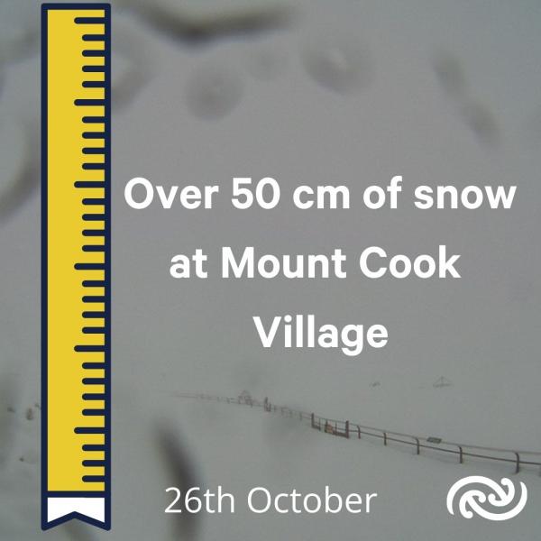
Over 50 cm of snow was measured at Mount Cook Village on 26 October 2024
November
November was marked by dryness. High pressure over the northern parts of the country kept weather settled, while systems weakened before reaching the north and east. Ashburton and Taumarunui recorded their third-driest Novembers, while Napier experienced its driest spring in 70 years. The month ended with a preview of summer, as temperatures climbed into the high 20s, with Napier Airport exceeding 30°C—its earliest since 2019. Meanwhile, Cantabrians welcomed the improved Canterbury Radar after being turned off for nine weeks while having 30-year old technology upgraded.
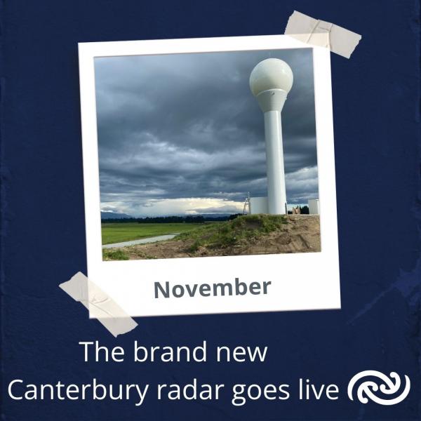
The Canterbury Radar went live on 28 November after an upgrade to replace 30-year-old technology
December
December began on a warm note, with the first heat alerts of the summer issued as the month got underway. Blenheim stood out as one of the hottest spots, reaching 32.5°C on the 5th—its second-warmest December day on record.
While colder bursts made occasional appearances, much of the country experienced above-average temperatures throughout the month. This warmth was bolstered by a return of northerly airflows in the latter half of December.
The second half of the month also brought a significant shift in rainfall for the east of the North Island. After a notably dry start, with parts of Central Hawke’s Bay reporting drought-like conditions, wet weather returned as rain flowed into the region from the east. Gisborne Airport recorded over 200 mm of rain, marking its wettest December since records began in 1937.
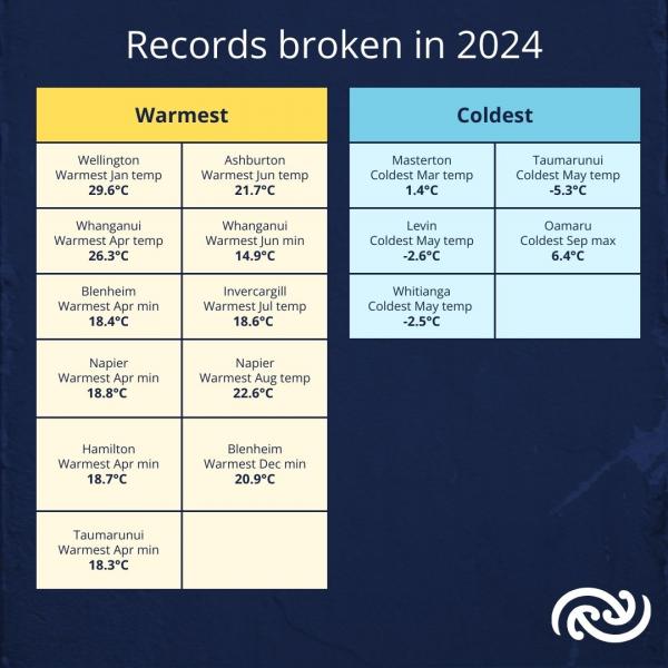
Temperature records broken in 2024
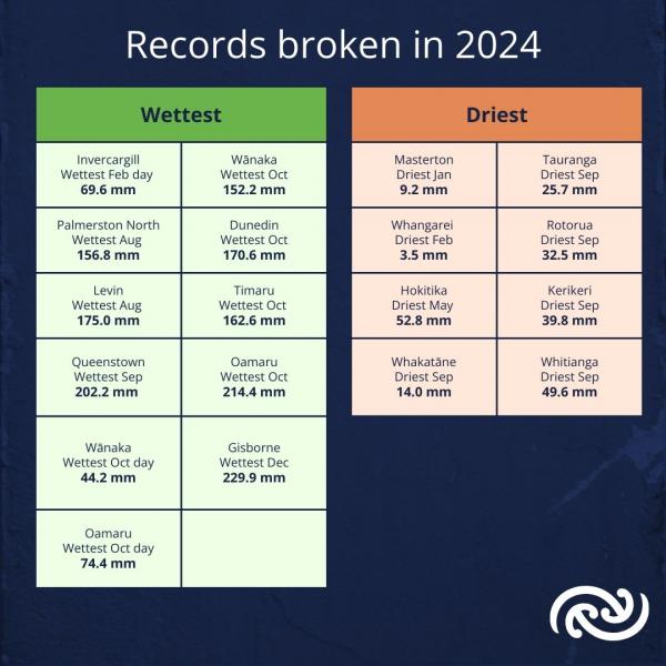
Rainfall records broken in 2024
As we move into 2025, the unpredictability of our climate reminds us to stay prepared and keep an eye on the skies. Our team of meteorologists will continue working hard to bring you the best, most accurate weather information, helping you stay informed and ready for whatever conditions lie ahead. Happy New Year - Ngā mihi o te Tau Hou!