5 years on from the 'big snow' of August 2011

The photos in this blog were taken by MetService staff in August 2011.

Image by Ian Attwood

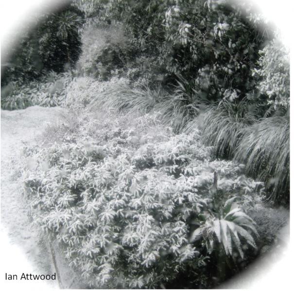
Photo taken by Ian in Karori, a western suburb of Welington.

We’ve just come out of a cold, snowy spell – the most significant of this winter so far. Ski fields nationwide are well topped-up, the Tararua range has been textured with snow after a pretty bare winter, and parts of the central North Island continue to suffer the effects of substantial snowfalls and drifts.

Warnings, Watches and Outlooks

Sitting out in the middle of the ocean, New Zealand is vulnerable to extremes of weather from all directions; from the remains of tropical systems barrelling in from the north, to cold winter southerlies bringing a blanket of snow.

As New Zealand’s designated national meteorological service to the World Meteorological Organisation (WMO), it is MetService's responsibility to provide clear, concise and timely warnings of severe weather that is likely to affect New Zealand.

What defines severe?

Napoleon’s Winter

What would New Zealand’s history be like without the First and Second World Wars? Blame the terrible Russian winter and Napoleon’s folly according to historian Adam Zamoyski in his riveting book 1812 Napoleon’s Fatal March on Moscow. The losses suffered in the invasion, particularly to his cavalry, ensured Napoleon’s downfall the following summer. That led to an aggressive Germany unified under a militaristic Prussia while in Russia, the Tsar came to believe he was God’s instrument on Earth.

Rugby Weather: Snow and the Lions

The first test between the All Blacks and the Lions in 1930 was played at Dunedin’s Carisbrook Park just after a snowstorm. Rain started in the morning then turned to snow during the curtain raiser. It became almost impossible to make out the players and some of the crowd went home while others sheltered under blankets and umbrellas.

Early October Snow

October 2009

The snow that closed the Desert Road and Napier-Taupo Road from Sun 4th to Tue 6th  October 2009 was unseasonable.  It was caused by a low pressure system deepening over the area at the same time as a cold southerly flow arrived, resulting in moist air being cooled from below in a cauldron of lowering pressure.  This produced an unusually heavy amount of snow over a wide area. The weather map for noon on Sunday shows the low pressure system forming over the Central North Island

Canterbury Snow, 10 May 2009

With clear skies over most of Canterbury on Monday May 11th 2009, there was  a good look at the fresh snow that fell the previous day, Sunday (10th May).  Here's the view late Monday morning  (around 10:30am) from NASA's Earth Observing System Terra Satellite,

2009-05-10-2225
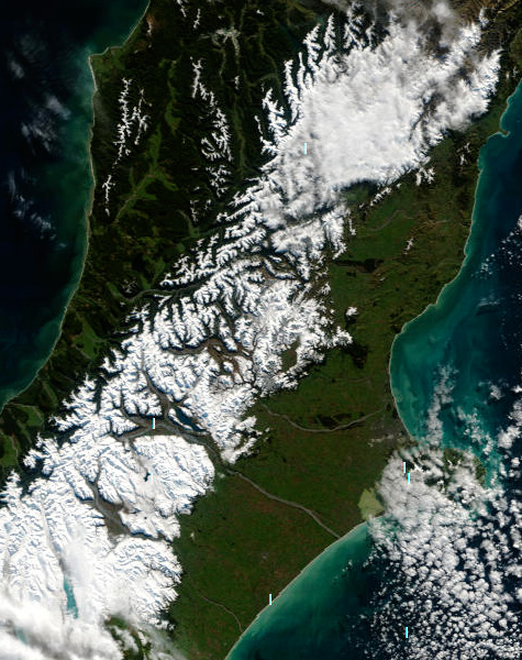
Fresh snow on the Alps and Canterbury foothills - as @ Monday 11 May 2009. (Image courtesy of MODIS Rapid Response Project at NASA/GSFC.)