Summertime convection
Georgina Griffiths
The Northland lee trough
Many Auckland boaties head north for the summer break, up to the Bay of Islands and sometimes beyond, to the Cavalli Islands and Whangaroa Harbour. The prevailing southwest winds should mean a run up the coast. Right? Wrong. You need to know about the Northland lee trough.
Understanding the long range forecast
Resolution counts
Weather forecasting is basically an ‘initial value problem.’ This means that if weather models could capture the current weather perfectly i.e. correctly initialise the current state of the atmosphere, then in theory, they could forecast the future weather accurately well beyond the present limit of a week or so. After all, the atmosphere is a fluid, and follows strict laws of physics.
The difference between weather and climate
It may seem obvious. Weather is what we experience locally day-to-day and week-to-week, while climate is a background signal sitting ‘behind’ the weather, observed at the seasonal, annual or even decadal time scale. But the interplay between what is dominate in the short-term and what prevails in the longer run, is not so straight forward. For example, 2015 was a very dry year for regions in the north and east of both islands of New Zealand. But there were rain events in these areas, and some of them were very heavy.
World Meteorological Day 2015
Climate Knowledge for Climate Action
The Southern Annular Mode (or SAM)
New Zealand lies mid-way between the tropics and the Southern Ocean, and our day-to-day weather can arrive from either direction.
Christmas past
Christmas Day in New Zealand can be a hit and miss affair, weather wise. Some years, a High arrives in time for Santa. Christmas Day 2009 was beautifully fine and warm across the country, with Dunedin hitting 32°C, and many other centres approaching 25°C.
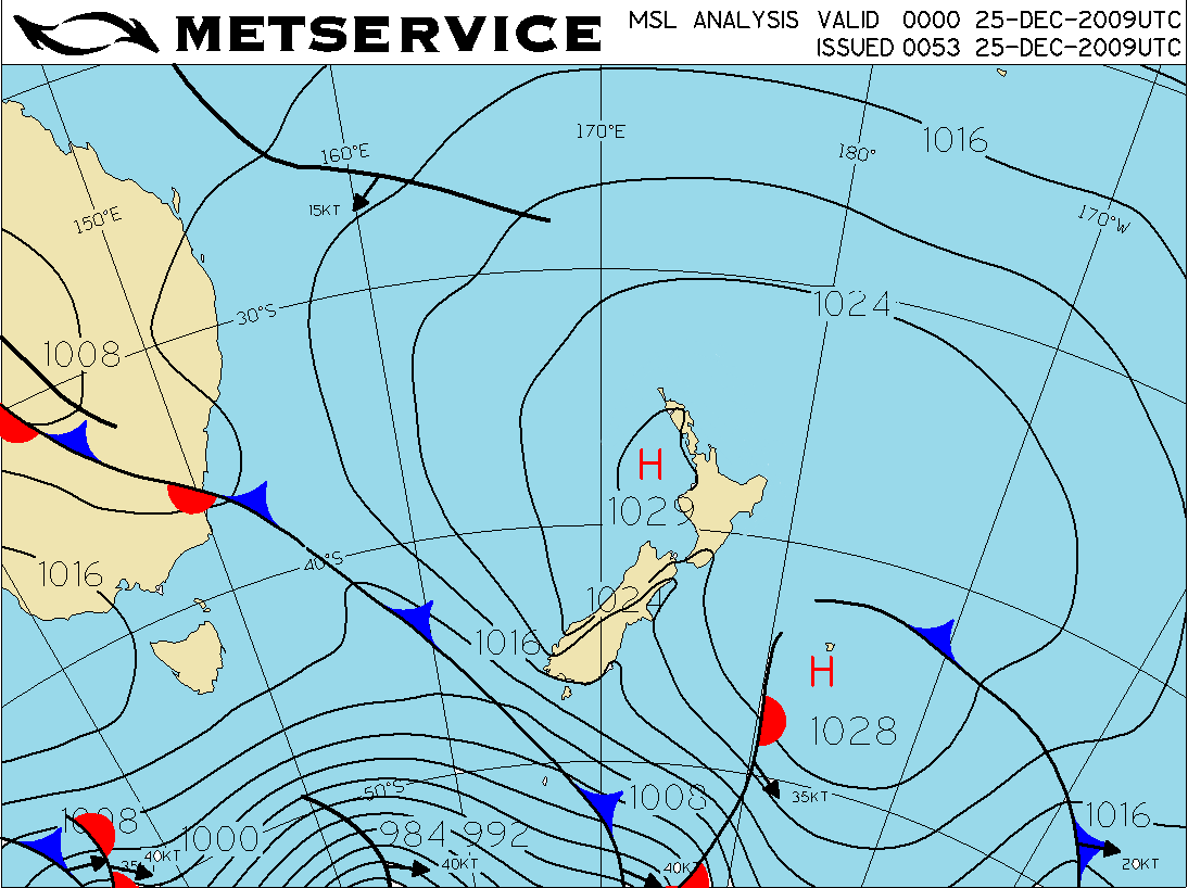 Midday analysis for 25th December 2009.
Radar and mariners – a long relationship
The development of modern radar started in 1886, when German physicist Heinrich Hertz showed that radio waves could be reflected from solid objects. In 1904, another German, Huelsmeyer, was the first to build a simple ship detection device, successfully detecting a ship in dense fog. In the pre-war period (the 1930s), many nations were working on radar devices. A major advance occurred once systems were developed that allowed short ‘pulses’ of radio energy to be generated, allowing the range of the object to be determined by timing the pulses.