Different parts of New Zealand are prone to different types of cloud. Use this handy guide to determine what types of cloud you get in your area, and where to go for some variety!
Near to the mountains
Different parts of New Zealand are prone to different types of cloud. Use this handy guide to determine what types of cloud you get in your area, and where to go for some variety!
Near to the mountains
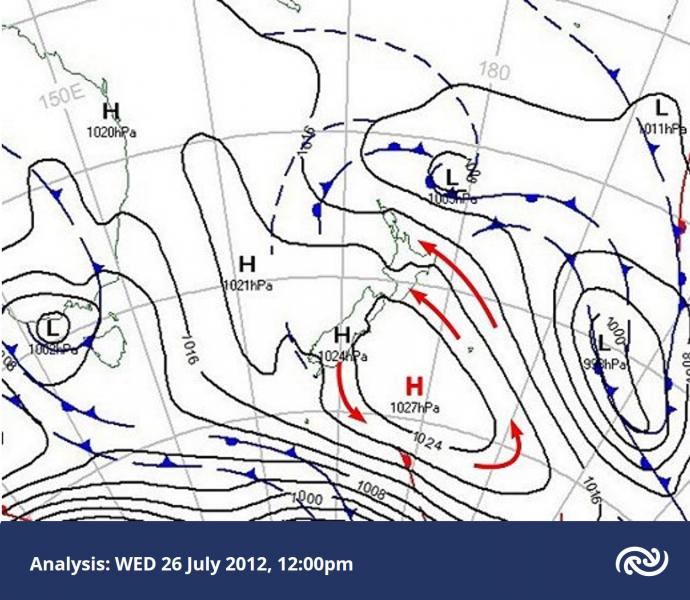
On Thursday 26 July 2012 a cold southeasterly airstream flowed onto the North Island, around an anticyclone centred just east of the South Island.
In this blog post we’ll look at some interesting small-scale cloud structures around the country on this day.
Below is the weather map at midday on Thursday 26 July. The red arrows show the sense of the broad-scale rotation around the anticyclone.
Clouds come in many different types and are characterised and named according to both their shape and height in the atmosphere. While a single snapshot in time at a given location may only contain one type of cloud, there are many days when multiple cloud types can be observed in the sky at once. The satellite images below is a nice example of different cloud types sitting at different levels above Waikato. Here's what the satellite image looked like Saturday afternoon 3 July 2010, for southwestern parts of Waikato near Kawhia Harbour: