The Japan Meteorological Agency launched a geostationary weather satellite called Himawari-8 in October 2014. “Himawari” means sunflower, and the name has been given to a series of satellites that we can look forward to in coming years. “Geostationary” means the satellite rotates “in sync” with the Earth, always above the same point over the equator.
satellite
MetService Satellite Dish Installation.
A satellite receiver ("dish"), for improved reception of data from polar-orbiting weather satellites, was installed at MetService Head Office in Kelburn in February 2013.
Benefits
Polar-orbiting weather satellites yield rich information about the atmosphere, valuable for New Zealand weather forecasting. Benefits of faster access to more data, and sharper identification tools, include:
Cloud structures over NZ on 26 July
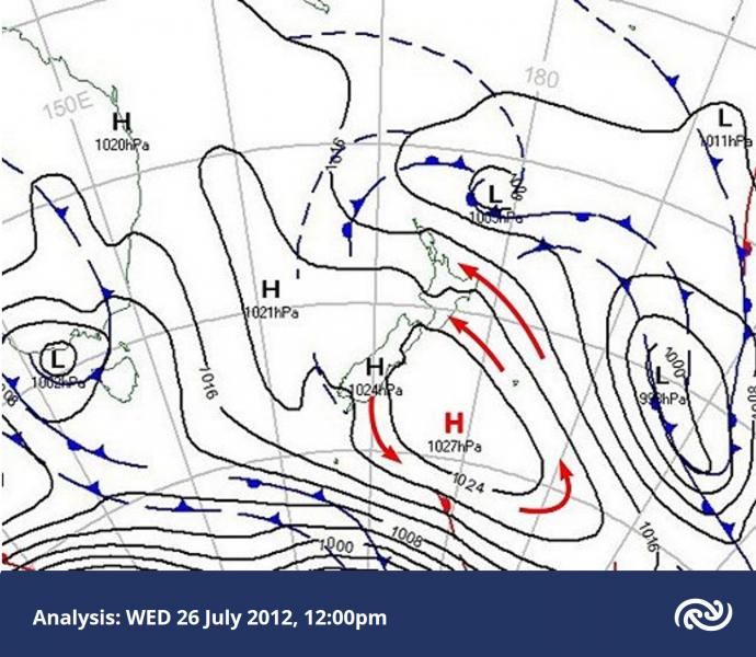
On Thursday 26 July 2012 a cold southeasterly airstream flowed onto the North Island, around an anticyclone centred just east of the South Island.
In this blog post we’ll look at some interesting small-scale cloud structures around the country on this day.
Below is the weather map at midday on Thursday 26 July. The red arrows show the sense of the broad-scale rotation around the anticyclone.
The Effect of Resolution
Sunny weather dominated the country due to a large anticyclone covering the country and the Tasman Sea during the second week of July 2012.
Canterbury Snow, 10 May 2009
With clear skies over most of Canterbury on Monday May 11th 2009, there was a good look at the fresh snow that fell the previous day, Sunday (10th May). Here's the view late Monday morning (around 10:30am) from NASA's Earth Observing System Terra Satellite,
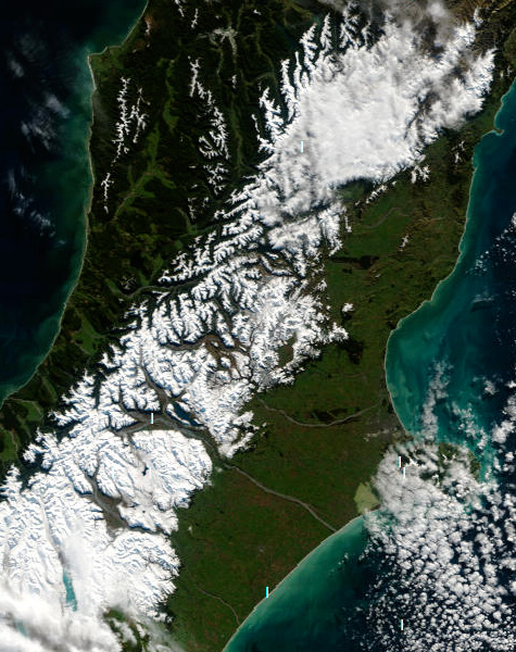 Fresh snow on the Alps and Canterbury foothills - as @ Monday 11 May 2009. (Image courtesy of MODIS Rapid Response Project at NASA/GSFC.)