Accurate weather forecasting requires three key ingredients – trustworthy observations, reliable computer models and experienced meteorologists.
Before the computer age and the satellite era, forecasters were reliant on weather observations from land stations, ships, and balloon soundings from which they could predict the movement of high and low-pressure systems and fronts.
Computer modelling has completely changed the forecasting game during the past three or four decades. Most of the MetService forecasts you read on the website or see elsewhere are the result of highly trained meteorologists studying a range of different models and deciding which ones, or which combination of them, are picking the most likely future weather outcomes.
These computer models have an endless appetite for crunching mind-blowing amounts of data.
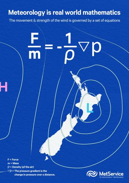
(Above: One of the many equations used to help model the atmosphere)
How do they do it?
Observations are taken from as many sources as possible, right across the planet. All these figures are fed into the models, which use complex mathematical equations reflecting the physics of the atmosphere to produce simulations of its possible future evolution.
Each model has its own personality, its own strengths, and weaknesses in covering our part of the world. This is where the experience of the forecasters and their geographical knowledge comes in, determining which weather situation from which model is the most likely to come true and how it will be influenced by local conditions and features such as Cook Strait and the Southern Alps.
At MetService, we use several of the most-respected global weather models to aid our forecasting.
Probably the most consistent is the European Centre for Medium-Range Weather Forecasts (ECMWF) model, generally recognised as the best-performing of the global models. As well, we consider runs of the UK Met Office model, which is very good when it comes to predicting the development and movement of mid-latitude weather systems.
The GFS model, generated by the National Centers for Environmental Prediction (NCEP) in the United States, is also consulted, although this is perhaps not as steady and reliable in this part of the Pacific as the ECMWF model. On top of that, we get modelling from meteorological services in Canada and Japan, and from the Bureau of Meteorology in Australia.
We also run our own in-house models to simulate the turmoil of the atmosphere and can operate these at much higher resolutions to reflect the idiosyncrasies of Aotearoa New Zealand’s landscape. We can run these with data points just 200 metres apart, which takes into account the different terrain of an area and whether it is forested or urban, which can make a significant difference to temperature and winds across a short distance.
Are they any good though?
The models themselves are constantly being tweaked by their operators to reflect the latest research findings and to keep up with new technology. The users of the models are also changing what they require from them.
In recent months there has been some discussion about whether climate change may be affecting the running of the models and especially their outcomes. Is it possible that an increasing number of more extreme events are pushing the models beyond their comfort zones into unknown territory?
The jury is still out on this. One thing that is for certain is that the basic physics of the atmosphere, on which the models are constructed, has not changed.
What has changed, though, is how often the conditions that lead to extreme weather are now occurring in our warming world. So, the models which are really good at picking bog-standard weather are being asked to deal with potentially severe weather situations more often.
What about Artificial Intelligence?
Like in any other industry, it is hard to predict just how machine-learning and artificial intelligence will affect weather forecasting.
AI-informed weather models have recently been found comparable to, or have even out-performed, physics-based models. But these AI-informed weather models aren’t coming in cold – they are first ‘trained’ on the physical models and then add a layer of prediction on top.
Then of course there remains the task of interpreting what the output of such a system might mean for the activities or safety of end-users.
At MetService we continue to work with the operators of modelling systems to ensure we get the best from them, while continuing to develop our in-house models. We have a keen eye on developments in the AI field and the opportunities it will bring. At the same time, we continually improve our forecasting expertise, which includes an understanding of the strengths and weaknesses of any modelling system.
By doing so, we will be in the best position to identify the risks future weather may bring, and how these are best communicated to those concerned.